

SEATTLE — Puget Sound Extended Forecast
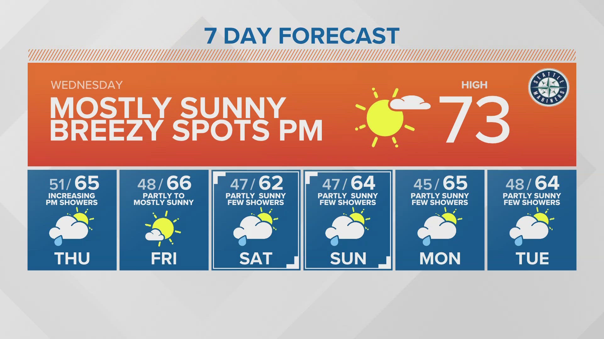
Wednesday: Mostly sunny. Lows in the low 50s. Highs in the upper 60s and low to mid-70s.
Thursday: Partly to mostly cloudy. Showers increasing late afternoon and into the evening, favoring northern areas. Lows in the low 50s. Highs around the upper 60s 70 degrees.
Friday: Partly sunny. Chance of a few showers. Lows in the upper 40s. Highs in the mid 60s.
Saturday: Mostly cloudy with off and on light showers. Lows in the upper 40s. Highs in the upper 50s to lower 60s.
Sunday: Partly sunny. Chance of a few showers. Lows in the upper 40s. Highs in the mid 60s.
Monday: Partly sunny. Chance of a few showers. Lows in the low to mid 40s. Highs in the low to mid 60s.
Tuesday: Partly sunny. Chance of a few showers. Lows in the low to mid 40s. Highs in the low to mid 60s.
Discussion:
High pressure continues over Western Washington, keeping mostly sunny skies and relatively warmer temperatures for Wendesday. Wednesday will be very similar to Tuesday, with upper 60s around North Sound and low to mid 70s south of Seattle. The coast will be a few degrees cooler with upper 50s and increasing cloud coverage.
Updated models are bringing rain back into the forecast a bit earlier than initially expected. Thursday, a weak disturbance approaches Vancouver Island by the morning. Washington starts the day dry but cloudy. By lunchtime, showers move into the state, favoring the north Cascades and foothills to start, then a few stray showers drop south into the evening. Accumulations will be minimal south of Seattle, if anything.
Friday is now trending mostly dry with a few lingering showers. This pattern will continue into the weekend and next week with a mix of clouds, sun and a few showers and highs in the mid 60s.
As we near the halfway point for the year, Seattle is still unseasonably dry and has lower rain totals than other major west coast cities. Since January 1, Sea-Tac has observed just 13.89" of rain. That's less than San Francisco (14.8"), Los Angeles (15.89") and Portland (19.98"). With no major rain chances in the forecast, this dry trend for WA will continue.