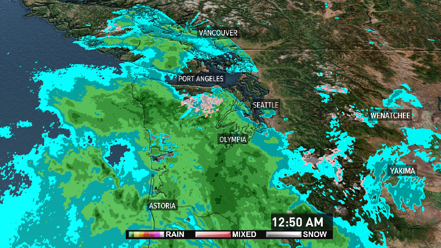
Weather

More Rain & Snow

Cool moist unstable air will continue to direct showers, thunderstorms and breezy weather into the western areas through Sunday morning. A warm front will move through the area Sunday night followed by a cold front on Monday. A weaker cold front will cross the area Tuesday followed by showers from an upper level trough of low pressure on Wednesday. All of this will keep showers and rain in the picture through the middle of the week.

A weak upper level ridge of high pressure on Thursday will lower the chance of rain, but another frontal system will probably reach the area Friday or Saturday

The Cascades & Areas east:

A Winter Storm Warning continues for the northern & central Washington Cascades where 6 to 12 inches of snow could fall down as low as Snoqualmie Pass (3000 ft.). The south Washington and north Oregon Cascades could get 4 to 6 additional inches of snow tonight down to 3000 feet. Expect the next wave of precipitation to occur Monday evening ahead of a new cold front producing mainly rain showers across the mountaoins of eastern Oregon and a rain/snow mix in the higher elevations. At the same time colder air will push across the Cascades lowering the snow levels.

Another ftront wil arrive Tuesday night and bring rain showers with snow above 3500 feet in the Cascades and 4500 feet in the eastern mountains. A trough of low pressure will develop over this area and snow levels will lower again on Wednesday.

Meteorologist Don Carson


Click here for a free download of the latest Adobe Flash Player.

Personalize your weather

Enter your ZIP code, city, state, airport code or country.